In order to further study and implement Xi Jinping’s Thought on Ecological Civilization and guide the whole society to firmly establish and practice the concept of “lucid waters and lush mountains are invaluable assets”, the Central Propaganda Department and the Ministry of Natural Resources recently publicized and released “The Most Beautiful Nature Guardian” to the whole society.
Some of them resolutely guard cultivated land, permanent basic farmland, and ecological protection red lines, contributing to consolidating the foundation of national food security; some patrol mountains, rivers, and forests day and night, using their hard work and sweat to ensure ecological safety; some focus on mineral resource exploration and development research, and use science and technology to promote the green development of natural resources; some innovate to solve the problem of resource registration and confirmation, and practice their original aspirations with heart; some have fought on the front line of geological disaster prevention and control for many years, protecting the safety of people's lives and property…
This issue invites 9 "Guardians of the Most Beautiful Nature" to share their stories of measuring mountains and rivers with their footsteps, watering green with sweat, and solving problems with wisdom.

Shi Xiaojun took a photo with the national flag after completing the underwater mission. bright pictures
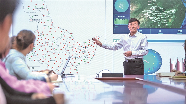
Ding Zhengjiang (first from left) is looking for gold mines. bright pictures
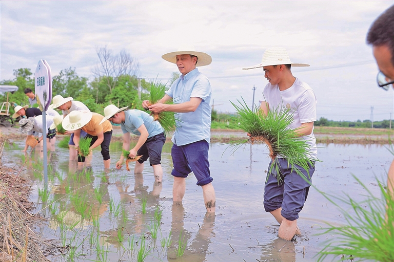
Wang Weimin (second from right) is planting rice in the field. bright pictures
Liang Anbao teaches during a skills training. bright pictures
Understand the secret language of mountains and rivers through persistence
Narrator: Ding Zhengjiang, Captain of the Sixth Geological Brigade of Shandong Provincial Geological and Mineral Exploration and Development Bureau
I have been fighting on the geological front for 26 years, and on average I spend more than one-third of my time in the wild each year. If you want to be serious about geological prospecting, you must go to the wild and get first-hand information.
The Liujia beryllium mine project in Datuan, Shandong Rongcheng is the first project for which I independently carried out systematic exploration. Prospecting is like searching for missed sweet potatoes in a sweet potato field: sometimes you find a bulge in a place, and there may be sweet potatoes underneath; in some places, sweet potato seedlings are exposed, and if you dig down along the seedlings, you might find a surprise. With this persistence of "following the lead", a new beryllium ore body was discovered in this project. We systematically evaluated this beryllium deposit, which is currently the only one in Jiaodong area. The moment the results were verified, it was like digging out a treasure from the ground, and my feeling about geology changed from "interest" to "love".
In 2014, I led the team to achieve a historic breakthrough in prospecting in eastern Jiaodong – the discovery of the Liaoshang deep gold mine in Muping, Rushan, with a gold resource of 69 tons. It was the first extra large gold mine in eastern Jiaodong. One day, while inspecting the core, I noticed something "odd" about the mineralized veins. After repeated comparisons and careful combing, it was found that the gold-bearing veins in this mining area are not mainly filled with pyrite and quartz, but are mainly filled with pyrite and carbonate minerals.
This discovery conflicts with previous industry practices and conventional understandings of mineral exploration. Why? I boldly put forward a hypothesis and based on this preliminary construction of the corresponding mineralization model. Facing pressure, I organized a team to re-catalog all the rock cores and keenly captured the close relationship between carbonate (dolomite) veins and gold mineralization, which pointed out a new direction for subsequent mineral exploration. Finally, after exploration, the first extra-large gold mine in eastern Jiaodong—the Liaoshang deep and peripheral gold mine—was discovered. This breakthrough expanded the scope of prospecting in the Jiaodong mining area and opened up a new prospecting direction.
Over the past 20 years, I have presided over and participated in more than 100 geological exploration projects. Geological prospecting requires not only stepping on the soil and taking root in practice, but also looking up to the stars and daring to innovate. I know that as deep mineral prospecting becomes more and more difficult today, traditional experience and hard work alone are far from enough. We must rely on technological innovation to lead prospecting breakthroughs. My team and I will continue to work hard.
Vow to be a coral guardian deep in the blue sea
Narrator: Shi Xiaojun, senior engineer of the South China Sea Ecological Center of the Ministry of Natural Resources
In order to protect the beautiful corals, we have poured our youth and sweat on the vast expanse of blue waves in the South China Sea. Over the years, from Dongshan, Fujian, to the offshore coasts of Guangdong, Guangxi, and Hainan, our survey footprints have extended southward step by step, covering the broader hinterland of the South China Sea.
If frontline investigation is “measured with feet,” then technological innovation is “guarded with brains.” In the face of increasingly complex ecological challenges, innovative thinking and advanced technology must be used to give wings of wisdom to coral reef protection.
Before building a three-dimensional monitoring system and early warning model, we must first solve the most basic question: What are the names of those underwater corals?
You must know your own coral best. Due to the lack of systematic and authoritative coral identification data in China, scientific research work is often restricted by others.
After five years, my team and I completed the first professional illustrated guide of Nansha coral species in China, which included more than 170 types of reef-building corals. This will not only help with coral survey and monitoring work, but also allow the public to better understand corals.
We also established the country's first coral reef ecological database and a national coral reef monitoring and supervision system, which eventually produced the country's first high-precision "one map" of the coral reef ecosystem. Finding out the status of coral reef resources marks that my country's coral reef protection has entered a new stage of "active early warning and smart management" from the traditional "passive response". In addition to the innovation of technical means, I also took the lead in building a complete coral reef survey and assessment system, and presided over or participated in the formulation of a series of standards such as the "Technical Guidelines for Survey and Assessment of the Current Status of Coastal Ecosystems Part 5: Coral Reefs", which filled the gap in domestic standards in this field.
Years of persistence stem from a pure wish: to make every reef complete and every cluster of coral alive. I will continue to stay on the front line of coral reef surveys and develop underwater robots, AI recognition systems, etc., to make protection more accurate and cover a wider area.
Turn rural land into a "treasure pot"
Narrator: Wang Weimin, Member of the Party Committee and Deputy Director of the Natural Resources and Planning Bureau of Anji County, Zhejiang Province
Standing in the fields, I felt at ease. Since I started working in 1994, I have been on the front line of cultivated land protection and comprehensive rural land consolidation. I have participated in the transformation of land consolidation in Anji to comprehensive land consolidation and ecological restoration in the entire region, and witnessed the transformation of beautiful resources into beautiful industries and rural land into a "treasure pot" for farmers.
In the past, Anji used to be a piece of land in front of the house and behind the house, with half-divided fields on the mountain slopes, and cultivated land scattered here and there. It was not uncommon for agricultural production to be "mismatched in space and function." How to break the situation? The fundamental method is to optimize the spatial layout of agriculture and achieve concentrated and contiguous cultivated land by "replacing mountains with mountains and merging small fields with large fields."
In 2012, Anji County fully implemented the comprehensive land consolidation project. After several months of visits and surveys in batches, continuous coordination with towns and villages, data comparison, and planning and demonstration, we finally formed an executable, forward-looking and constructive plan, which has also become the cornerstone of the rapid advancement of land remediation in Anji.
As one of the first batch of pilot villages for the comprehensive land consolidation and ecological restoration project in the entire region, Zhugenqian Village is a typical representative. In the past, Zhugenqian Village had a disordered land spatial layout, dispersed and disordered industries, imperfect infrastructure, and a weak village collective economy. Now, 3,000 acres of land in the core area of the village have been connected into one area, and transplanting, fertilizing, and harvesting are fully mechanized, ensuring that grain planting costs are reduced, efficiency is increased, and production is stably increased.
I have also begun to "addition" to the comprehensive land improvement work in the entire region, so that while "each has its own beauty" in the countryside, "beauty and beauty are shared". Up to now, Anji County has implemented a total of 143 comprehensive land improvement projects of various types, reclaimed more than 10,000 acres of construction land, and added more than 30,000 acres of cultivated land.
I firmly believe that there are no villages with poor resource endowments, only misallocated resources. What we hope is not only to solve the problems of fragmentation, disorder and inefficiency of land use, but also to help one village after another find a new engine for its own development.
Go deep into the earth to find light and heat
Narrator: Wang Guiling, researcher at the Institute of Hydrogeology and Environmental Geology, Chinese Academy of Geological Sciences
I have always had a geothermal dream in my heart: let the energy from the depths of the earth penetrate the rock formations, turn into light and heat, and enter the homes of thousands of people.
After working, the first project I participated in was the "Survey and Evaluation of Geothermal Resources in Eastern my country", which was a systematic geothermal resource mapping of the vast land east of 106 degrees east longitude. At that time, without the assistance of systems such as Beidou and GIS, most data did not even have complete records of longitude and latitude. I go out every day to collect materials, come back to check literature, write reports, check information one by one, calculate locations, and mark the locations of scattered hot springs and geothermal wells on the map one by one.
Over the past five years, I manually marked the locations of more than 2,000 hot springs and geothermal wells on a large-scale map to form a geothermal resource distribution map. This gave me a systematic understanding of my country's geothermal resources for the first time. Since 2011, the China Geological Survey has launched national geothermal resource survey and evaluation projects. I have taken the lead in organizing hundreds of technicians from more than 30 units across the country to conduct systematic surveys of geothermal resources in various provinces. This survey allowed us to truly understand this treasure house of resources buried under our feet. In April 2017, after the establishment of Xiongan New Area, I led the team to the site and took the lead in sounding the charge to build a "global model of geothermal utilization" in Xiongan New Area.
Xiongan is one of the areas with the best conditions for geothermal resource development in the country. At the beginning of the project, everyone thought that the geological conditions in the Xiongan New Area were relatively simple. However, with the in-depth geophysical exploration and subsequent drilling verification, the actual situation was far more complicated than expected. In order to ensure the accuracy of drilling locations, I decisively decided to significantly increase geophysical exploration work and revise my understanding of the distribution of geological structures through comprehensive analysis. In the end, with detailed data and accurate judgment, we completed a total of 26 geothermal survey wells in Xiongan New Area, all of which achieved the expected goals, with a survey accuracy of 1:50,000.
Geothermal energy has the advantages of cleanness, stability, safety and efficiency. Nowadays, the picture of beautiful China is slowly unfolding, and I am also thinking about how to layout geothermal work during the "15th Five-Year Plan" period and even in the longer term. Our voice of asking the earth will echo in the magnificent journey of green development.
Accurately "settling" mountains, rivers and lakes
Narrator: Bianba Zhuoma, a fourth-level researcher from the Natural Resources Bureau of Lhasa City, Tibet Autonomous Region
I have always felt that it is a blessing to be able to measure this land with my own hands.
I walked on the grassland with surveying and mapping instruments on my back, verified plots in the farmland under the scorching sun, and recorded data by the river valley under the snow… When I first started working, I followed my old colleagues and traveled all over the mountains and rivers of Lhasa.
In the work of natural resources, the confirmation and registration of real estate rights are related to the vital interests of the people. Every bright red real estate certificate is not only a legal document, but also a family's peace of mind.
To facilitate and benefit the people, information construction is indispensable. In recent years, the real estate registration work in Lhasa has realized informatization and digital management. In order to turn "sleeping resources" into "visible asset ledgers", we took the lead in building a display module for the results of the unified confirmation and registration of natural resources in Lhasa. The boundary range, resource type, quantity and quality of each registration unit are clear at a glance, and the ownership relationship and ownership subject are clearly identifiable. The originally professional and obscure results have become intuitive, easy to understand, and easy to use, providing precise guidance for subsequent management and protection.
When promoting the confirmation of rights to nature reserves, I found that some villagers in marginal areas had a vague understanding of the boundaries of the protected areas, so I immediately organized the production of a Tibetan-Chinese bilingual brochure. The team members were active in the fields and at the village entrance. We explained the policy in the most down-to-earth language and explained the protection requirements over and over again to the rights confirmation draft.
In the final analysis, our job is to accurately "settlement" the mountains, rivers, lakes and forests that nurture us, so that every inch of land and every piece of water has its own "identity file", and to protect this "ecological property" for future generations – because every "ecological ID card" contains the expectations of the masses and hides the future of this land.
"Going towards danger" among thousands of mountains and valleys
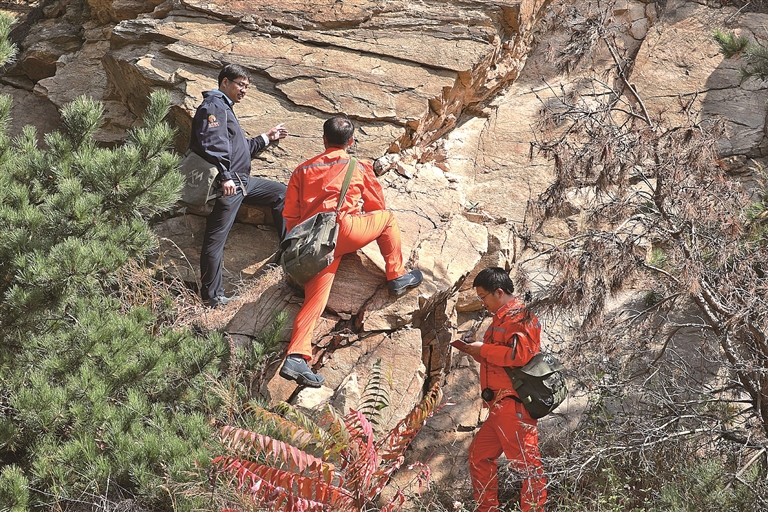
Narrator: Xu Liang, Director of the Geological Disaster Prevention and Control Division of the Sichuan Provincial Department of Natural Resources
For more than 20 years, I have been "walking towards danger" day by day, drilling into ravines, checking for hidden dangers, conducting monitoring, eliminating dangers, making plans, and carrying out governance. My footprints have spread to more than 100 geological disaster-prone counties in Sichuan… It is my mission to protect lives. This responsibility and responsibility is my mission.
Earth disaster prevention and control must not only face the immediate danger, but also take a long-term perspective and use systems to weave a disaster protection network covering the entire region. In response to the key difficulty of weak grassroots geological disaster prevention and control capabilities, my colleagues and I created the first full-time monitoring system for geological disaster mass detection and prevention, further consolidating the job responsibilities of monitors and tightening the chain of responsibility for mass monitoring and prevention. At the same time, professional and technical personnel are promoted to be stationed in counties, villages, and villages to provide technical services for disaster prevention and control, ensuring that 21 cities (states) and 175 disaster-prone counties (cities, districts) in the province have professional forces to provide technical support. During the flood season every year, more than 200 professional teams are stationed on the front line in the province. This system has been implemented since 2008 and has played a key role in supporting scientific disaster prevention and reduction at the grassroots level.
In order to bring the knowledge of disaster prevention and reduction to thousands of households, we, together with the Youth League and Provincial Committee, took the lead in exploring and implementing the "Youth Volunteers, Protecting Life" earthquake volunteer service action. We formed nearly 4,000 volunteer service teams and carried out more than 69,000 publicity and education, emergency drills, hidden danger investigation and other activities, with a total of more than 1.1 million participants. We carefully edited and produced publicity and warning educational films, animated videos, movies, popular science books, and picture books, and extensively promoted activities such as "Little Hands Holding Big Hands" for the first lesson of the school year. After years of infiltration, the awareness and practical capabilities of grassroots cadres and masses in disaster prevention, disaster reduction, and risk avoidance have been continuously improved.
In the past two years, we have explored and promoted the "unveiling and leading" work of technology-empowered disaster prevention, reduction, and relief, tested the effectiveness of technology-empowerment with actual combat scenarios, and further improved comprehensive prevention capabilities such as refined investigation and evaluation, precise monitoring and early warning, and precise "wake-up calls and responses," making technology a "hard-core force" to protect lives.
Just because the thousand-year-old county is green
Narrator: Xu Hui, Secretary of the Party Committee of Ruichang Natural Resources Bureau, Jiangxi Province
Ruichang is "the first city where the Yangtze River enters Jiangxi Province". Backed by the Yangtze River, environmental protection is the "hard lever"; mining is the cornerstone of "strengthening the county industrially". How to balance the relationship between protection and development tests the determination and wisdom of the government and natural resource management departments.
In November 2013, I became the head of the former Ruichang City Bureau of Geology and Mineral Resources. At that time, quarries were everywhere, the mining industry was in chaos, and the environment was seriously polluted… In order to improve the ecological environment and make people live and work in peace and contentment, we focused on the mines in the county to "reduce points and control volume, iron-fist rectification, and comprehensive improvement." After five years of hard work, the number of open-pit quarrying companies in the city was controlled to less than 10, and the number of mines was reduced by two-thirds.
In order to straighten out the natural resources supervision path, I have thought of many ways and explored and implemented supervision measures such as the installation of mining rights signboards, wire fences in mining areas, floor markings, drone law enforcement, and mine video surveillance. At the same time, it also actively promotes the establishment of a "joint approval, joint law enforcement, joint inspection, and joint case handling" mechanism in Ruichang City, effectively changing the current situation of "alone" law enforcement by the natural resources department, and more effectively protecting mineral resources.
After many years of work, I know that cracking down on disordered mining and closing mines is not the end of mine management. How to scientifically and rationally realize the value of resources and serve economic and social development is the correct answer to the development and utilization of mineral resources. After investigation, in 2015, Ruichang City formulated and promulgated relevant measures for "clean ore" transfer, taking the lead in implementing the "clean ore" transfer work model in the province, and exploring the construction of a "collection-storage-cleaning-supply-management" full chain system for mining resource development. Up to now, Ruichang City has successfully listed three mineral rights for sale, with a total transfer price of 3.56 billion yuan, effectively promoting the transformation and upgrading of local mining companies in Ruichang, making the mining economy bigger and stronger, and providing new ideas for the appreciation of national resource assets.
Next, I will continue to protect this thousand-year-old county with my heart and soul, and accompany it to become green and prosperous.
"Mobile Sentinels" sow green seeds
Narrator: Huang Weugu, a full-time ecological ranger from Jingang Town, Liuyang City, Hunan Province
In 2008, I became a forest ranger and started spending time with the mountains and forests. As a full-time ecological ranger, my area of responsibility is in Pingwan Village and Dangui Village, Jingang Town, managing and protecting 8,441.43 acres of forest land, including 53 listed ancient trees.
Once, I discovered an ancient camphor tree growing abnormally during patrol. I promptly reported the situation to the forest chief's office, which helped the public security organs successfully crack the "6·06" case of endangering national key protected plants, eliminated five ancient tree poisoning gangs, and saved more ancient and famous trees. This case was also selected as a typical case of the Supreme People's Court punishing crimes that destroy forest resources in accordance with the law.
Over the years, I have measured mountains and forests with my feet, and my total patrol mileage has exceeded 130,000 kilometers. During the day-to-day patrol, I also accumulated my own set of "local methods." In order to prevent fire, some old people in the mountains want to burn grass and ash to fertilize their fields, and often light a fire beside the fields. In this regard, I realized that not only should we dissuade in time, but we should also strengthen prevention. Therefore, my mountain patrol route also has a focus.
The protection of forest resources in Jingang Town faces extremely special pressures. The forest land here is often closely adjacent to fireworks production companies, folk temples, and family cemeteries, so fire hazards are everywhere. Every year during the Spring Festival, Qingming Festival, Ghost Festival, and during the busy farming period, I will go to households to preach about the ban on straw burning, patrol along fields and mountains and forests, and persuade villagers who plan to burn straw.
Now, when you open the Forest Chief App on your mobile phone, you can see the management grid, patrol routes, and patrol point distribution at a glance. With the help of technology, our work can be carried out better.
In Hunan, there are 54,000 ecological rangers like me who are on the front line of forest protection all year round. We measure our responsibilities with our steps and protect the green with our sweat. We are the "mobile sentinels" of forest and grass resource protection. Nowadays, I have another identity – a public welfare preacher. In the future, I will go into enterprises, schools, communities, and villages to convey the concept of ecological protection to more people, so that this green seed can take root and bear fruit in a wider area of land.
The promise of "walking and measuring accurately" will never change
Narrator: Liang Anbao, President and Party Secretary of the Second Geographic Information Cartography Institute of the Ministry of Natural Resources
Use footsteps to measure mountains and rivers, and use data to record times. The road we surveyors take is never a smooth one, but every step counts.
From 1:50,000 and 1:10,000 to today’s high-precision maps, from traditional flat-panel meters to satellite remote sensing and UAV aerial survey, the technical methods are changing, but the commitment of surveyors to “reach and measure accurately” remains unchanged.
At the end of 2012, the first national geographical census was launched. The Heilongjiang Surveying, Mapping and Geographic Information Bureau is responsible for the census tasks in parts of the western part of the country and Heilongjiang Province, covering nearly 20% of the land area, involving mountains, rivers, forests, fields, lakes, cities and towns, transportation and many other elements. At that time, I had just finished 17 years of field work and was transferred from the current second largest geological survey team of the Ministry of Natural Resources to work in the Basic Surveying and Mapping Division of the Heilongjiang Bureau of Surveying, Mapping and Geographic Information.
The geography and national conditions census operation has a wide scope, involves many industries, has high technical requirements, and is difficult to organize and implement. When checking the pattern determination of a province in the west, due to the phase and resolution of the image, the boundaries in some places were not clear, and the results were inconsistent with the collected data. Although it was within the allowable range of national regulations, I requested that it be re-verified to find more powerful evidence to ensure the accuracy of the data. After the project team collected information from multiple sources and verified it on the spot, we solved this problem.
It would be better to take one more test than lose an inch. Through this census, Heilongjiang Province has established a complete geographical census background database to find out the current status and spatial distribution of natural elements such as mountains, rivers, forests, fields and lakes, and humanistic elements such as towns and transportation. These data were later used for ecological monitoring of the Northeast Forest Belt and the Northern Sand Control Belt, analysis of changes in the main agricultural product-producing areas of the Sanjiang Plain and Songnen Plain, and research on urban spatial patterns. The “simultaneous census, side monitoring, and side application” model has been promoted and practiced across the country by gathering the practical experience of surveying and mapping brother provinces and jointly exploring and forming it.
In addition, I also participated in the preparation of technical regulations and production plans for the National Geographic National Census, researched and formed a set of mature technical routes, achieved a leap from "0" to "1", and laid a solid foundation for the comprehensive rollout of the National Geographic National Census work.
The responsibility that surveyors shoulder is to provide data support for the harmonious coexistence of humans and nature. It is this kind of protection that makes green waters and green mountains measurable, recordable and inheritable. We will continue to use our persistence day after day to protect the future of future generations.
"Guangming Daily" (Page 07, March 17, 2026)